X
GO

Water School

How do you build a lake (reservoir)?

While the process may vary for each location, here’s a general outline of how a reservoir goes from idea to reality.

Once a need for water in an area is established, a site for the reservoir must be chosen. Several factors go into this decision, including nearness to a source of demand, a feeder supply of water (such as a river or creek), the geological suitability of the area and engineering constraints. Other factors considered could include impact on the environment, the local population, and historically or culturally significant sites.

Once a site is selected, hydrologists calculate early estimates of reservoir capacity and water supply availability to determine the lake’s yield. After these preliminary sighting and feasibility studies are complete, requests for a permit to impound water of the state is submitted to the Texas Commission on Environmental Quality.  Other environmental studies and permits are required from federal and state agencies.  When permits are approved and complete, officials begin acquiring the land to be covered with water.

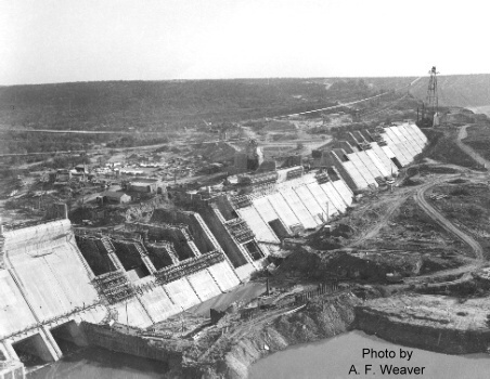
Once land is secured for the new reservoir, a series of pre-construction studies are conducted and state and federal permits are acquired. A final dam design is completed based on the various studies and once the permits are obtained, the dam is built and water is impounded.

The lake-building process can take several years or even decades. Throughout the process, officials hold public meetings to inform and obtain input from the public.

Related

Share

Search
Categories

The information provided on this site is intended as background on water within the Brazos River basin. There should be no expectation that this information is all encompassing, complete or in any way examines every aspect of this very complex natural resource.

If you have questions about a post or would like additional information, please contact us or call 888-922-6272.

Tags
planning electricity authority sediment climate use filter water supply impound fishing chlorine oxygen water cycle gage water code estuary water plants algae indirect re-use chlorides rights industrial speaker subsidence classification contaminants releases PAM ground water subsidence district wetlands dissolved solids canoeing corps of engineers minerals watercourse sludge flood control lake direct re-use landscaping parasite flood recreation lake level limestone E. coli map dam salt riparian golden algae appropriation water anaerobic septic environment flood pool calcium gate riverine camping bay conservation farming inland mgd mitigation medicine acre-foot evaporation main stem spillway aerobic supply costs volume aquifer soil channel subwatershed legislation potable hunting stream watershed water use system municipal septic system smell spring insurance taste hydrologic cycle pollutants E coli wastewater electric companies meta tag solids marsh mission brackish drilling water clarity basin water treatment storage water quality inundated hydrilla reservoir rain boating lawn cfs tributary streamflow treatment kayak sewage industry emergency use jobs wildlife pharmaceuticals employment sanitation lake levels agricultural well lakes agriculture hydrology habitat depth drinking water bottled water streamflow dock consumption organic invasive plants golden algea groundwater permit governance gulf xeriscape measure drought infection allens creek reservoir corps wetland granbury gas Board TCEQ possum kingdom monitor bed and banks clarity USGS canoe water planning runoff fork contract reservoirs lake maps quality fish kill salinity environmental hydropower surface water effluent mainstem turbidity beneficial use precipitation river water rights acre-feet biosolids fertilizer