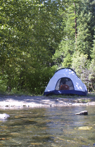
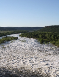
Many love to take to the Brazos River and its tributaries to paddle, hunt, camp or just generally have a
good time. But Texas weather sometimes can be as wild and unpredictable as an Old West frontier town.
With this in mind, if you are going to spend any time
on the river, it pays to plan ahead and be
aware of ways to learn about river and weather conditions to keep your visit a safe one.
The Brazos River Authority has made several resources available on our Web site to help you stay informed
about river and lake levels and conditions. A good first place to check is the Authority’s home page,
here. Whenever flooding is likely along the Brazos or its tributaries, the Authority will
post information toward the top of the tan-colored strip on the page’s right side.
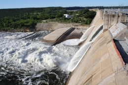
Even when there is no rain, the Authority may release water from Possum Kingdom, Granbury and Limestone
lakes to fulfill a need by customers downstream. You can find alerts about such pending significant
releases on that Web page’s right side.
At the bottom of the Authority home page, a chart shows current gate releases from dams at these lakes.
There is also a chart showing current lake levels.
The U.S. Geological Survey maintains a series of gauges you can check on the Authority’s site to see the
water level and stream flow in real time at numerous spots around the Brazos basin. The “River and
Reservoir Levels” page, which can be found through a pull down menu on the blue “Water Levels” tab at
the top of the Authority home page, can also be found by clicking
here. By using the interactive map you
can find the river’s depth in feet and speed in cubic feet per second (cfs). Readings are also searchable
back 120 days.
Understanding river flows and knowing when a gate will open is important, when you consider one gate at
Possum Kingdom Lake’s Morris Sheppard Dam releases about 9,600 cfs.
The following chart will help you understand the quality of the river flows for paddling.
|
200 or less cfs
|
Below minimum needed for paddling.
|
|
201 to 500
|
Satisfactory but may require a good amount of paddling or portaging.
|
|
501 to 1,200
|
Ideal conditions.
|
|
1,200 to 3,000
|
Hazardous conditions, requires plenty of skill, not for beginners.
|
|
3,001 to 5,000
|
Experts only.
|
|
5,001 or more
|
Flood conditions, not safe for anyone at any expertise level.
|
The National Weather Service is also a good resource for planning a safe trip to the river. You can check
here to see the weather forecast for the area you plan to visit, or as important, upstream. On the site you
can also check for weather watches and warnings, and take a look at the current radar image. The weather
service also has an interactive map of river gauges that can help track potential flood conditions, on
the Advanced Hydrologic Prediction Service’s Web site,
here.
The Authority also has a system to alert residents downstream from its three reservoirs through phone call
or e-mail whenever water will be released. Anyone interested in participating in this service should contact
the office of the appropriate lake for more details.
If you have questions, please feel free to contact the Authority's Public Information
Office at (888) 922-6272 before you go to help make your visit to the river a safe one.